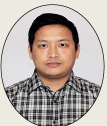
Job seeker profile

Mr. TENSUBAM DAVID MEETEI
7.7
Personal information:
| Name : | Mr. TENSUBAM DAVID MEETEI |
| Birth Date : | 1991-07-17 |
| Country : | India |
| Position: | Highway Engineer |
Work Area :
| Skill: |
|
| Industry: | Construction/Engineering/Cement/Metals |
| Functional area: | Highway / Structure |
| Designation : | Highway Engineer |
| Desire job type : | Permanent |
| Employment type : | Full Time |
| Preferred shift : | Day |
| Expected salary: | 7.70 Lacs |
Profile summary:
I have been working as a Highway Engineer and Survey Engineer in both DPR as well as Supervision Projects with domestic and International Consulting firms in Highways and Structures and familiar with IRC Codes and MORTH Specifications.I am confident and energetic individual who can easily learn and implement new skills at the workplace itself. I am also very friendly with colleagues and I know that coordination and communication is the key to achieve success in a term based environment..
Education details :
B.Tech/B.E.
| Specialization : | Civil Engineering |
| Institute name: | Siddaganga Institute of Technology |
| Marks / Percentage : | 7.28 |
| Passing year: | 2016 |
Work Experience :
Highway Engineer
2021-07-19 - Presently working
| Company name : | K&J Project Pvt. Ltd. |
| Annual salary : | 7.00 Lacs |
| Industry : | Construction/Engineering/Cement/Metals |
| Functional area : | Highway / Structure |
Conducting Joint Survey along with the Client for the Project Alignment. • Conducting the various Inventory and Conditions Survey. • Conducting major and minor intersections Survey along with the Bus Bay locations. • Preparation of Schedules of the Existing Corridor. • Preparation of various Preliminary Geometric Alignments using Civil 3D through Geolocation mode. • Preparation of Inventory and Conditions Survey Report and Compiling of various Survey data and then submitting to the Team Leader for the preparation of Inception Report. • Dealing with the Client for various stages payment RA Bills. • Preparation of various draft letters for the Utilities Shifting and Land Acquisitions Works. • Meeting with various Utilities departments like WaterSupply, Sewer line, Powerline 11kV, 33kV, BSNL OFC, Jio, etc for their shifting and existing plan collections. • Preparation of existing and relocation plan in AutoCAD along with the Utilities departments. • Preliminary Survey along with the Client for the Land Valuation and Standing Structures cost which is to be included in the Feasibility Report. • Collection of various Maps from the Map Section of the Revenue Department for superimposing with the proposed horizontal alignment to identify the locations where the land has to be acquired. • Preparation of draft 3a Schedule and 3A Schedule. • Conducting Survey for the Land Acquisitions and reporting to the Team Leader. • Monitoring of all Land Acquisition documentation works. • Monitoring the following Data Collection Works: -Butterfly Marking and fixing of DGPS Points. -Topographical Survey using Total Station -Establishment of GPS Pillars and TBM Pillars. -Traversing throughout the Project Corridor. -Lidar Survey on the existing Alignment. -Geotechnical Investigation and Pavement Investigation Works.

